Coastal Wetland Research
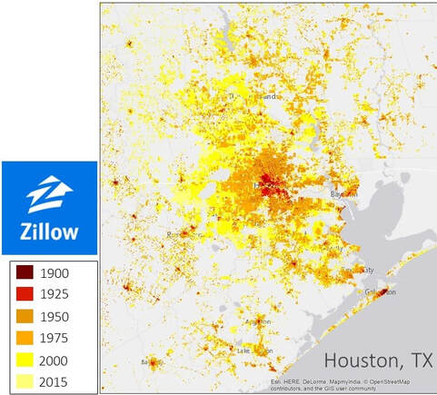
How do human development and coastal wetland ecosystems interact?People in the US over the past century have moved to the coast, leading to expansion of coastal communities into areas at risk of flooding and degradation of natural ecosystems. While we know how many people currently live on the coast, historical information on coastal communities and coastal wetland loss remain unknown. Through the use of a unique real estate data set from Zillow that spans 150 million housing records from pre-1900 to 2015, we explore when and where people have settled in coastal areas across the U.S. Results suggest growing coastal communities during the first half of the 20th century, resulting in the spread of coastal settlements along southern and western coasts of the US. More recently, more and bigger buildings were added to coastal communities. These trends are different across geographic regions, type and size of coastal area (beach towns, cities). By combining these growth trends with historical maps from USGS, we are elucidating the interactions between coastal wetlands and development.
We have recently been funded by NSF Humans, Disasters and the Built Environment. Check out the abstract. |
|
|
|
What factors drive wetland formation?
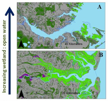
Sediment availability is a fundamental determinant of wetland formation, growth and vulnerability because it influences both the ability of marshes to build vertically, and their tendency to expand or erode laterally. As such, history of sediment delivery could shape present distribution of coastal wetlands along the eastern North American coast.
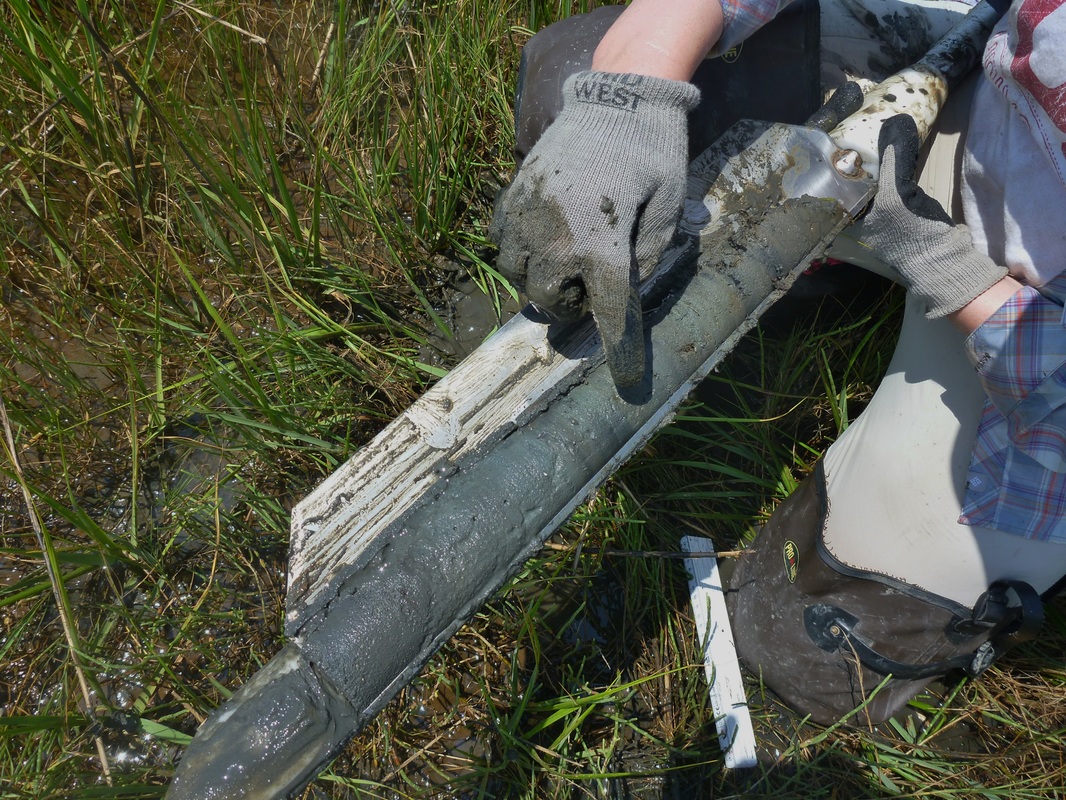
Agricultural expansion and deforestation during the 17th -19th centuries led to significant upland soil erosion in eastern North America, but effects of this sediment pulse at regional and continental scales has not been evaluated. I used existing and new sediment cores to quantify extent and distribution of wetlands that formed during the period of initial agricultural expansion in the Eastern US. I quantified the extent of mid-Holocene and recently-formed marsh using an extensive data set of coastal wetland basal ages; study sites are arrayed along a gradient of upland influence. |
|
|
|
